NSW 8624-S – Tombong For Discount
- Estimated Delivery : Up to 4 business days
- Free Shipping & Returns : On all orders over $200
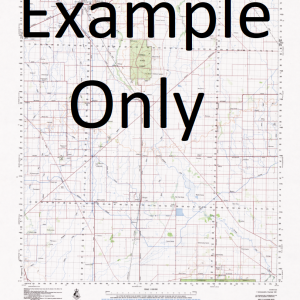
This Topographic Map is produced by the New South Wales Government.
This map is supplied in digital in PDF format, which means it can be printed at home or sent to a professional printer for a 100% scale reproduction.
At this scale, 2cm on this map represents 1km on the ground. A standard map (which is square) covers an area of approximately about 25km by 25km, with a contour interval of 10m. This map contains natural and constructed features including road and rail infrastructure, vegetation, hydrography, contours, localities and some administrative boundaries.
Back Creek In Part Mount Alexander Alexander Amboin Creek Amboyne Creek Ambyne Creek Adams Peak Adams Creek Back Creek Basin Creek Bear Gap Biddi Big Edbo Creek Big Edbo Gap Big Edbo Mountain Big Edbo Range Bluff Creek Black Spring Black Jack Range Black Jack Ridge Black Jack Mountain Black Jack Black Flat Creek The Black Flat Black Flat Black Bull Creek Boundary Creek Boundary or Kangaroo Gully or Rocky Creek Bridge Creek Buckland Mount Buckland Bug Edbo Creek Chinamans Creek Clarkes Creek Clears Creek Corrowong Corrowong Creek Corrowong Falls Corrowong Ridges Cotteril Creek Deep Creek Farmers Creek First Creek Gap Creek Gattamurh Creek Gibraltar Ridge Gows Creek Grahame Collins Gap Grenville Hanging Rock Hobbs Ridge Horse Creek Horseshoe Gap Jerome Hill Jerrys Flat Creek Jerrys Flat Kangaroo Ground Creek Currowang Currowong Creek Currowang Falls Branch of Currowong Creek Darema Deep Gully Gibraltar Creek Gibraltar Range Hobbs Range Jerrys Flats Jerrys Flat Creek In Part Johnsons Creek Lambing Creek Lambing Gully Limestone Creek Lions Point Little Forest Little River Long Corner Creek Long Gully Mcguigans Creek Mcguigans Gap Mckeachies Creek Mclaughlins Creek Marambago Creek Mathews Creek Merambego Creek Merambego Ridge Merrumbulo Merumbago Range Merumbagee Creek Middle Creek Minnehan Creek Minnehan Hill Mountain Creek Mount Trooper Napier O Hares Creek Pheasant Ridge Pine Creek Pipeclay Creek Purgatory Creek Quidong Quidong Creek Quidong Tower Reedy Creek Richmonds Gully Right Hand Creek Rix Rodney Mount Rodney Rodney Range Rodney Ridge Rossys Creek Rossies Creek Round Flat Round Hill Mount Sampson Sandy Camp Creek Sandy Creek Sandy Gully Sawpit Creek Sawpit Gully Second Creek Shed Creek Sheldons Creek Sideling Creek Skippa Creek Slippery Hole Creek Snodgrass Back Creek Snodgrass Back Gully Snodgrass Creek Snodgrass Plain Spicer Hill Spring Creek Spring Flat Creek Stewarts Amboyne Creek Stockyard Creek Stock Yard Creek Stockyard Flat Stockyard Flat Creek Stockyard Gully Stockyard Range Stockyard Ridge Stokes Flat Creek Talbingo Tarrabandra The Gap The Tower Thompsons Creek Thompsons Gap Tingaringi Tingaringy Creek Tombong Tombong Creek Tombong Range Upards Creek Wallamagga Creek Wallaroo Creek Warm Corner Wellsmore Hill Whelans Flat Creek Whelans Flat Gully Windmill Hill Wobbyong Mountain Wollendibby Creek Wollondibby Wollondibby Creek Youbong Gully Bulli Creek Bulli Lookout Burnt Hut Crossing Byadbo Byadbo Creek Byadbo Flat Byadbo Gap Byadbo Mountain Byadbo Mount Byadbo Range Currawong Falls Merambego Range Merumbadgee Creek Byadbo Wilderness Boorpuk McKeachies Creek Mount Tingy Ringy Tingy Ringy Creek Wallaby Creek Kalimna Stony Creek Matong Creek Maclaughlin River McLaughlin River Kangaroo Ground Bradbo Mountains Mount Byadbo Bullis Lookout Currowang Creek Bombala River Airlie Park Wallendibby Tingiringi Hillcrest Currowidgin Karachi Mount Tingi Ringi
| Title | Pdf Download |
|---|
Related products
-
GA 3959 – Worral Online Sale
$12.50 -
GA 3952 – Hoking Cheap
$12.50 -
GA 3960 – Dukes Dome Sale
$12.50